
At 1120 on Wednesday 21 May we slipped our lines and continued upstream from Clairac. The weather continued with the glum overcast and the showers that we had been under with few breaks for several weeks. This must be one of the coolest and wettest Mays on record in this region.

The river banks are mostly wild, with occasional buildings along them. Some appear to be agricultural warehouses; this is a famous apple and prune plum growing area. There are a few chateaux, many shuttered and appearing abandoned.

Occasionally we passed more modern residences that appeared occupied and well cared for.

The most common structures along the river banks are the fishing shelters, many of them furnished with tables and chairs.

Seven kilometres along the river we passed a modern mooring float with a ramp leading to le musée du Pruneau, the Prune Museum. It was noontime as we passed and it was likely closed, so we didn’t stop.

We had thought of stopping in Granges-sur-Lot, which the guide shows as having moorings with water and electricity and indicates a bakery and grocery store in the village. As we approached we saw that the floats were missing. The pylons were there, as were the orientation signs and the electrical and water bourne, but without the floats, all this was redundant.

We continued along, passing a barge that appears to have had its last voyage.

Shortly upstream of this wreck we began weaving our way through a narrow channel marked with beacons and we wondered whether the demise of the barge was related to the rocky channel.

Two kilometres further along we arrived in Castelmoron and at 1300 we secured to the solid concrete wharf on the right bank, directly below the château. We were intrigued by the Moorish appearance to the château and we walked up to find out its background. The building is now la Mairie, the town hall, and inside we were offered a surly greeting and service by the woman behind the reception counter. She was the only person around and we likely interrupted her daydreaming. From the brochures she thrust at us, we unravelled some of the history of the building and of the town. The town and the château date to the thirteenth century and are named after the nearby marshes: Château des Marais or Mauron, later corrupted to Castelmoron.

Throughout the town are old buildings, some appearing to date to the fourteenth or fifteenth century. The church is relatively new, having been built to replace a thirteenth century one that had been demolished in 1845 to give access to a new bridge across the river. The château received its moorish embellishments around the same time. The new owner, born locally from an immigrant Portuguese family, had apparently been inspired by a visit to Spain’s Alhambra and converted the Romanesque architecture into Moorish.

Just upstream of the town is the next lock, a ten metre high one to surmount the dam for the hydro-electric plant. The decline of the mining industry up the river, combined by the increasing use of rail transportation, caused le Lot to be removed from the list of navigable waterways in 1926. Through the following decade large electric generating stations were built, with their dams flooding the old locks and weirs. In 1991 an isolated section of the river up and downstream of Cahors was reopened. In 1995 the bottom 50 kilometres from Aiguillon to Villeneuve-sur-Lot was restored to navigation. In 2001 a further 15 kilometres upstream of Villeneuve was put back in service and in 2010 this was extended to kilometre 75 at Lamothe. Work is in progress on linking the downstream 75 kilometres to the upstream section. We walked up the river bank to take a look at Écluse Castelmoron.

We followed along the top of a concrete retaining wall for about half a kilometre to the waiting wharf below the lock. The gate giving access off the wharf was locked, so leaving Edi on the wharf, I climbed over the fencing and sidled along to the stairs leading up to the dam’s control house. I spoke with the watchkeeper about locking through and was told that we would be seen as we approached, stay aboard and wait for the green light. The floating bollards in the chamber meant there was no need to disembark. I told him that would likely lock through the next day.

We headed back to Zonder Zorg, making it aboard shortly before the start of a torrential downpour. The rain continued heavily for nearly three hours, during which time the current in the river increased to about 1.5 metres per second past our windows.

There was a strong turbulence in the water as it passed, but with our spud pole down we remained stable.

I lowered some more slack on the spud pole line and monitored our mooring lines as the level of the river rapidly rose. When we had moored, the top of the leeboard was below the level of the wharf, and we had used the leeboard as a ramp to disembark. When the rain stopped, the leeboard was nearly 30 centimetres higher up the face of the wharf. I then understood why the wharf is so high.

On Thursday morning the sun was breaking through the clouds and the current in the river was down to a more gentle flow.

The river was back down toward its normal level

At 1020 we slipped and headed up the short distance to Écluse Castelmoron. By this time the clouds had mostly dissipated and we enjoyed a rare sunny day.

The lock was ready for us as we arrived.

Although at 10 metres height, it is much lower than the high locks on la Rhône, such as Bollène at 22.5 metres. However; it is only 5 metres wide, compared to the 11.4 metres of Bollène, so there is a feeling of being confined when at the bottom of the chamber looking up.
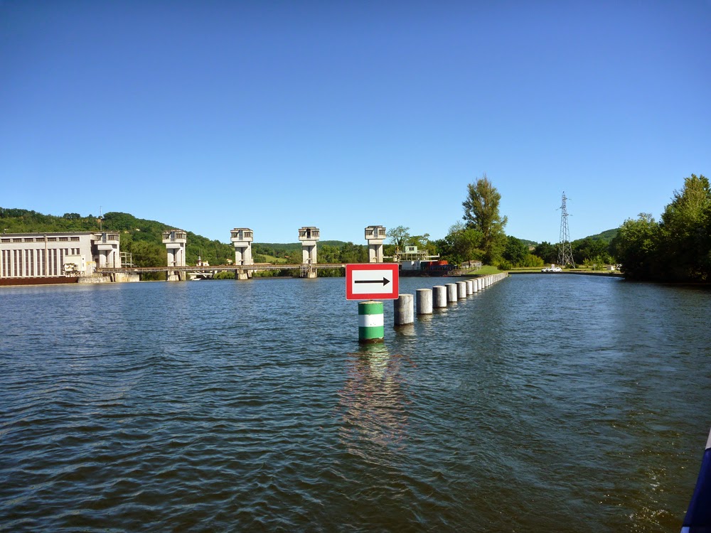
The channel leading past the weir to the lock is well protected with stout concrete pylons.

We emerged into a broad river valley.

After a couple of kilometres and an abandoned lock house, we began passing stately homes and châteaux gracefully set on the river banks.

For the first time in a long while we saw homes utilizing their waterfront, rather than hiding it. There were even private mooring facilities in front of some.

Near St-Livrade-sur-Lot we passed a major renovation in progress. An old two-storey house was being expanded tenfold or more with huge wings and rooms. This ten kilometre section of the river upstream of Écluse Castelmoron is the most active we have seen along the two thousand kilometres of French waterways we have travelled in the past year. Here we saw fine homes new and old, yacht clubs, sailing schools riverside restaurants and resorts. During my six years on the canals a decade ago in northern and eastern France I recall nothing near similar.

Above St-Livrade the fine riverfront properties diminished in frequency, then stopped. There are a few isolated châteaux, such as Château de Favols, but mostly the riverbanks are wild with occasional crude fishing shelters.
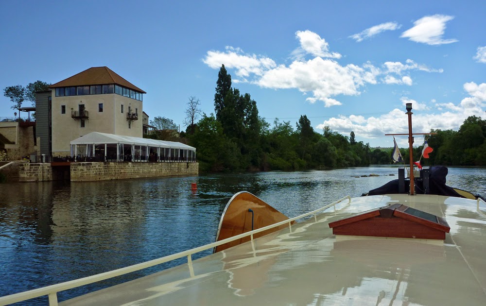
Twenty-five kilometres upstream of Écluse Castelmoron we negotiated a buoyed channel through a gap in the weir at a decommissioned lock. Instead of remaining abandoned, the lock house has been transformed into an upscale restaurant with a covered patio on a deck laid across the old lock chamber. As we went past we could see it was crowded with diners; it is only two kilometres from the city of Villeneuve-sur-Lot.

Villeneuve appears very attractive when approached from the river. It is called New Town because it received its charter in 1264 to be built as a replacement for the chateau and buildings destroyed earlier in the century as a punishment for the residents’ heresy.

The bridge is a seventeenth century rebuild of a 1282 fortified bridge that was washed away in floods. The original bridge had five arches, but the replacement was built with only four, one substantially larger to make it easier for the barges to negotiate in the currents.

We had planned on stopping here to explore the historic old city, but we were told of visiting boats being stoned and of mooring lines being cut. We had an uneasy feeling as we motored past the moorages, and we decided to continue upriver.

Two kilometres upstream is Écluse Villeneuve, where I secured to the concrete wharf to await its preparation for us.

I walked along the wharf and up the steps to take a look at what lay ahead. This lock is thirteen metres high and was completed in 2001 to bypass the large hydro-electrical dam that had decades earlier been built across the river. The lock chamber was full when we arrived and it took a long time to drain the 2.6 million litres of water from it.

Inside the chamber are eight floating bollards, four on each side, so securing Zonder Zorg for the ascent was easily and quickly done.

L’éclusier told us that Écluse Lustrac, the next lock sixteen kilometres up river was closed until Monday. Fortunately, we had already decided to stop for a day or two in St-Sylvestre just seven kilometres up. At 1516 we secured to floats on the right bank in St-Sylvestre, just downstream of Pont de Penne. About a hundred metres up the slope from the moorage is an Intermarché, just before it is a fuel station with diesel and a large selection of gaz tanks and across the street is a hardware store. An artisan bakery is half a block away and on a hilltop across the river is a medieval village to explore. St-Sylvestre was well suited to our waiting four days for the lock to reopen.
No comments:
Post a Comment