
On Friday, 18 July we had moored along a rubble bank on the branch of the canal leading out of Aigues-Mortes and had begun our preparations for ascending le Rhône. Besides restocking with fresh supplies from the supermarket a hundred metres from the barge, we began trying to make sense of the data on the CNR website.

La Compagnie Nationale du Rhône was set-up in 1933 with three main objectives: improvement of navigation conditions; creation of irrigation canals and the installation of hydroelectric plants to utilize the strong flow of the river. It appears that their main objective is now to generate electricity and that navigation has been relegated to an ongoing expense they must endure. A prime example of this are the flow rate charts on their site. These are given as water debits in cubic metres per second past a number of selected points along the river. To get these flow rates, they must measure the river current at each point and convert the speeds into volumes using the cross-sectional areas of the river at those points. This is very useful for hydroelectric plant operators, but is near useless to navigators unless they know each of the cross-sectional areas of the measurement points along the river. Nowhere does CNR publish the original current speed from which they calculate their volume flow. We were told that by multiplying the flow at Beaucaire-Tarascon by 0.0036 we would get the speed of the current at that lock in km/h. The table on the CNR site shows the volumes for the past twelve hours only, with no archive and no forecast. With the flow rather steady at about 1700 cubic metres per second through Friday afternoon and evening, we calculated the current to be just above 6 km/h at the lock.

Shortly after 1600 on Saturday we slipped and headed toward Écluse St-Gilles about 23 kilometres along. This lock takes boats from le canal du Rhône à Sète to le Petit-Rhône. From there it is 300 kilometres against the current to Lyon, the first 20 in le Petit-Rhône, the remaining 280 in le Rhône. We arrived at the lock shortly after its 1900 scheduled closing time and looked for a place to moor for the night to await its 0700 opening. The area was in the midst of reconstruction and there were no mooring facilities, so we turned around and retraced the last kilometre back to canal du Rhône à Sète and headed up it toward the town of St-Gilles.

Less than a kilometre up the branch we saw three short wooden mooring wharves, each about three metres long and each with a pair of bollards. We turned about again, placed our stern against the first wharf, dropped the spud pole and settled in for the night. To give us some forecasting of the river current, I had decided to watch the weather forecasts for areas where rains would feed the Rhône. On my iPhone I began following Geneva and Lyon for the upper Rhône, Macon and Chalon-sur-Saône for la Saône, which dumps into le Rhône at Lyon and Grenoble for l’Isère, which dumps into the Rhône upstream of Valence. It had been rather dry in all those places for a few days, but two and three days of heavy rains were forecast beginning on Sunday. From this, I expected a slug of water to enter the upper Rhône and take a couple of days for the resulting higher currents to reach us. We had a very weak connection in our mooring, so I could not update the weather forecasts nor the volumes in le Rhône.

We were up early on Sunday, timing our departure to have us arrive at Écluse St-Gilles shortly after it opened. We watched the light turn green as we approached.

I spoke with l’éclusier as we passed through the lock, and he confirmed my thoughts that the river current was normal at the moment.

We were delighted to find such a gentle current in le Petit-Rhône.

I upped the engine to 1600 rpm, which in still water gives Zonder Zorg 10 km/h, and in the light current we moved along at a bit above 9 km/h.

I expected the current to increase as we approached the main body of the Rhône, but sixteen kilometres along at PK 184, just four kilometres from le Rhône the current was still light.

We were still making above 9 km/h with turns for 10.

As we passed under Pont suspendu de Fourques and the flimsy wooden jetty that serves as Petit-Rhône moorage for Arles, the current began increasing.

I upped the engine speed to 1800 and we continued to move along at above 9 km/h as we neared the junction with le Rhône. The current appeared to be about 2.5 km/h with very little turbulence.

At 0950 we entered le Rhône and I ran for a while in the slower water along its right bank, making over 10 km/h with turns for 12.

We shortly had to work our way across the river to meed a down-bound hotel barge and we lost the lee of the bend and slowed to just under 8 km/h.

We continued up the river using where safe the reduced current in lee of its bends. We moved along through the water at 12 km/h and making between 7 and 10.5 over the ground. The main body of the river was moving at about 5 km/h and this showed at the bases of the beacons.

Just below Beaucaire we entered the bypass canal leading to Écluse Vallabrègues and the strength of the current increased. We were in a narrow branch carrying all of the water that was being discharged from the hydroelectric plant beside the lock. We passed through heavy turbulence under the bridges linking Beaucaire and Tarascon and were slowed to under 5 km/h. As we passed Château du Roi René we were back up to about 6 km/h.

At 1145 we arrived at Écluse Vallabrègues, having taken one hour and fifty-five minutes to do the 15 kilometres from our entry onto le Rhône. Our average was a little over 7.8 km/h. Thus far our theoretical calculations of expected conditions seemed to be acceptably close.

Above the lock the turbulence and current were much reduced and once we had left the narrowness of the diversion canal and reentered the river, we moved along at above 11 km/h. An hour above the lock we stopped at a new marina on the river at Aramon. We were low on water and we pulled in to see if we could get some. We were greeted by Olivier Pallier, a recently retired French fighter pilot. He had just three months previously opened the new marina complex, which offers a full suite of services, including short and long-term moorage, dining and local region tours. We told him all we wanted was water and he said it was at no charge. As we filled our tanks, we chatted with him of our common backgrounds as Air Force pilots and career officers.

After topping our tanks, we thanked Olivier and wishing him success with his venture, we slipped and continued up le Rhône. The weather ahead looked ominous, but we decided to press on. Edi dug-out my foul weather gear.

As we approached the mouth of la Durance we were hit by a severe squall line with a drenching downpour and winds of Force 10 and above. Edi retreated below. The wind was directly abeam so I put my back to it and glanced upriver from time-to-time through rain-splattered glasses. The frontal passage took more than ten minutes, though the severe winds lasted less than five before beginning to abate. Fifteen minutes after it had begun, the rain eased and the winds nearly died as we passed under the arches of Pont TGV Méditerranée.

Our progress up the river was very good, so we decided to press on beyond Avignon; we had spent a few days there on our way down river last year and both Edi and I had visited the city several times over the years. We passed through Écluse Avignon in the mid afternoon and continued up the river, passing along the way the ruins of Château de l’Hers on the riverbank and those of Chateauneuf du Pape across the fields and vineyards.

At 1800 we were at a fork two kilometres below the next lock, Écluse Caderousse. One branch was the canal leading to the lock, the other was the continuation of the river to the weir. We opted to follow the river to find a mooring for the night. Five kilometres up, near the village of l’Ardoise is a marina, but we were not headed there. Instead, our destination was to a pair of chart symbols about 1500 metres up the river that looked to be moorings. We slowly went past the overgrown sloping stone walls for a look and decided to turn about to use our favoured starboard side for a closer approach. The upstream wall had partially collapsed and we saw random stone rubble fouling the bottom alongside. We moved slowly along to the downstream wall, which appeared intact. At 1825 we secured alongside with the spud pole holding the bow and a line to a tree stump holding the stern. We had made 81.6 kilometres.

It was a very peaceful spot, far enough away from the wakes of the passing barges and out of the current. We slept very soundly and long. With steaming cups of espresso, at 0930 we slipped and headed back downstream in clearing weather to join the canal leading to the lock.

In response to my VHF call, l’éclusier said there was a down-bound commercial in the lock and we would have a short wait. We had barely secured on the waiting float when the lock door opened and a large hotel barge came out.

We soon got a green, entered and had the entire chamber to ourselves for the ride up the 8.6 metres.

Once we had cleared the lock, Edi went below and prepared a platter of open-face sandwiches and more cups of espresso for our breakfast, which we enjoyed as we moved along the canal back to the river.

As we regained the broad river two kilometres above the lock we saw our speed increase appreciably in the weaker current. I played with reduced currents in the lee of river bends and at times we were making in excess of 11 km/h with turns for 12. Midway along the 25 kilometre pound to the next lock we were still making above 8 km/h in the main current.
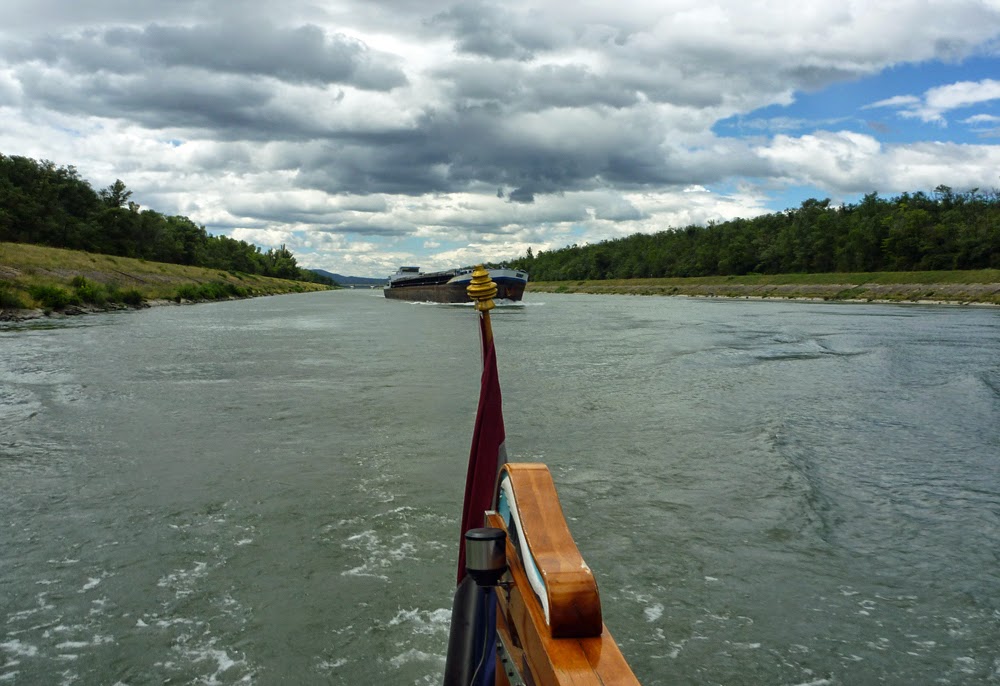
The canal leading to Écluse Bollène is over 10 kilometres long and carries the full flow from the hydroelectric plant down its relatively small cross-section. The current is noticeably stronger and we were slowed to below 6 km/h. We were steadily being overtaken by a large unladen barge.

It was alongside and moving at more than double our speed as we passed beneath the bridge 2 kilometres from the lock. With our reduced speed in the increasing current as we neared the lock, it would take us another half hour to reach the lock and we would fall too far behind the commercial to lock through with it. We resigned ourselves to a long wait for the lock to cycle up, discharge the traffic, reload and cycle back down.

Luck was with us; we came around the bend half an hour later to see the commercial still waiting for the lock to empty a group of down-bound vessels.

We had to slow only when we entered the slack water behind the breakwater at the mouth of the lock, and we followed the commercial into Écluse Bollène. At 22.5 metres, it is not only in the highest lock on le Rhône, but the highest lock in the European network.

Out of the lock we watched as the commercial quickly pulled away from us as we worked our way up the 20 kilometre canal above the lock that continues Bollène’s long bypass some of the greatest navigational hazards of the former untamed Rhône. The rocky shoals, the winding course and the strong current made boaters respect places like le Robinet de Donzère, la passage de Pradelle, le Banc Rouge, and le Désirade. After nearly three hours we finally left the stronger current in the confines of the canal, regained the river and passed beneath the cliffs of Donzère.

Five kilometres further along we came again to a fork. Straight ahead was the canal that led two kilometres to Écluse Châteauneuf, to the left was the continuation of the river leading to below the weir. We followed the river for half a kilometre to the marina in Viviers, where at 1608 we backed in on a small rickety finger and dropped the spud pole to hold the bow. We had come another 49.9 kilometres and had 166 remaining to Lyon. The river current had been increasing through the day and we were beginning to see the slug of water I had predicted from the two days of heavy rain in Geneva, Lyon and Grenoble. We expected to see the current increase further, so we decided to stay put in Viviers for two or three days until the current dropped to more reasonable levels.


