
Shortly after 1600 on Monday, 21 July we had secured stern-to in the small marina in Viviers as we expected the current in le Rhône to begin increasing. Across the fields behind us, an old flood plain of the river, was the town of Viviers, perched on a hilltop with a line of sheer cliffs.

Through the evening we were hit by a series of severe thunderstorms, but Zonder Zorg’s spud pole held her bow securely. We hunkered-down inside and studied at the graphs on the CNR website, trying to make sense of the convoluted information. After decreasing until 1300, the reported current at Viviers began steadily increasing through the afternoon and evening.

Thirty-five kilometres upstream at Valence, the current had begun increasing at least six hours earlier in the day, which made sense based on a five or six km/h current over that distance. I saw that we could expect a similar 30% to 35% increase in the current at Viviers by midnight as the result of upstream rains in Geneva and Lyon made their way down.

L’Isère drains the basin on the western end of the Alps, and there had been heavy rains in the areas around Grenoble. The river, which dumps into le Rhône a short distance above Valence, showed a near doubling in its flow volume over the corresponding period. With two days of heavy rains upstream of us, we settled-in for a two or three day wait for the current to reduce to a manageable rate.

After breakfast on Tuesday we walked toward the base of the cliffs to visit the weekly market. It was mainly filled with trinkets for the hotel barge passengers and other tourists. There were a few produce stalls with prices considerably above reality and at the fish truck we saw dos de cabaillaud at €37.50 per kilo. In the supermarkets these are generally between €15 and €20. We walked away empty-handed and continued up the narrow, winding streets into the town.

The town dates to before the Roman conquest. It became the capital of the Gaulish Helvii tribe and in the late Roman period it grew in importance as a bishopric and the capital of Pays Vivarais.

On the highest point is cathédrale Saint-Vincent, the seat of the Bishop of Viviers. Its tower dates from the eleventh century and the remainder of the building mainly from the twelfth century; it was consecrated in 1119. Because of the narrow streets, steep hill and abrupt cliffs, it is difficult to get a photo of the exterior.

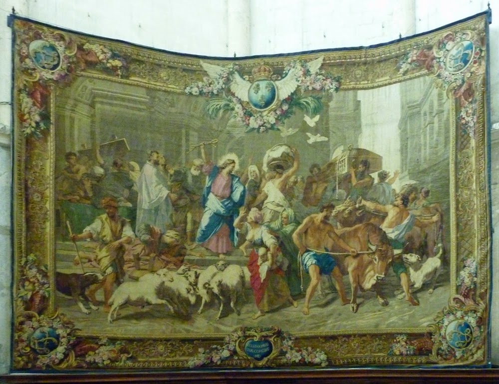
Inside, the apse is hung with a selection of very large tapestries with religious themes. These are difficult to view because of the poor light and the glare coming from the windows above them.

Behind the altar is an elevated platform with stairs, which allows a better viewing angle.
I climbed up the stairs to get a better look, but the glare from the windows made them very difficult to fully appreciate.

Back outside there is a large courtyard, likely once the bishop’s private gardens. It is surrounded on three sides by sheer cliffs and from it are views down over the town to the south and west.

To the north the river can be seen near the end of the line of trees that follow the road across the plain to the port.

Mid-afternoon, I pasted together portions of three previous screen captures of the water flow at Viviers to see the trend over the previous thirty hours. This showed the rate to have increased from slightly above 1400 when we arrived to slightly above 2200, an increase of nearly 60% in the current.

The following morning, the graph showed that the volume had paused slightly in the evening and then steadily increased overnight. It was now above 2400, an increase of about 70% from the time of our arrival.

The heavy rains had ended upstream and the past couple of days had been dry, so we expected to see an end of the spate of water coming down the river. On Wednesday afternoon we went to the supermarket to replenish our fresh supplies in preparation for a Thursday morning departure. The midnight graph showed a substantial drop in the flow, confirming our predictions.

The online graph on Thursday morning showed the flow rate had continued its downward trend, and was sitting just above 1800 cubic metres per second. The pause in the decrease around midnight and the small rise through the small hours was most likely from flow control measures by the CNR when hydroelectric power demand dropped overnight. With industrial power demands increasing, I expected to see the drawdown to continue.

Sitting on a masonry wall and a series of pylons just off our port bow were two large hotel barges, each with 150 to 200 passengers. Each day since we had arrived, two or three had moored here, either for the night or for several hours for the passengers to visit the town.

At 0725 we slipped, headed out of the marina, ran down the river half a kilometre and turned up the two kilometre canal leading to Écluse Châteauneuf. Not long after we slipped, the two river cruisers followed and before long, one was overtaking us. The lock is 190 metres long and each of the cruise ships was well in excess of 100 metres, so I knew only one of them would head in.

I called l’éclusier and told him in a slightly questioning tone that we would follow Arosa Stella into the lock. He confirmed. Arosa Stella is within a few centimetres of the 11.4 metre width of the lock, and she took a long time to pump herself into the chamber.

There was plenty of room for the two of us in the chamber for the 16.5 metre lift.

We were soon out of the lock and into the eleven kilometre canal leading back to the river above the weir. The current was rather light above the lock, but nonetheless, I took advantage of the lee below the curves to gain some speed. Doing this, we often made speeds over the ground that were close to our speed through the water.

We had to be careful with this, since there was down-bound traffic that would be embarrassing to surprise. Fortunately, the banks are mostly sufficiently low to see over the curves and we were never surprised by any traffic.

We were still in the canal as we passed Montélimar and found the current to be around 5.5 km/h, slowing us from 12 to about 6.5. We were pleased with our progress and pressed on.

Once we broke out of the confines of the canal and were back into the broad and deep river, the current decreased considerably. Our speed increased by three kilometres per hour.

At 1000, as we approached le centrale nucleaire de Cruas, we were overtaken by Van Gogh, the other cruise ship that had left Viviers with us two and a half hours earlier.

In an obvious attempt to show how friendly and benign the nuclear power installation is, one of cooling towers has a mural painted on its upstream face. It appears to depict an innocently nude child playing with sand on a beach.

Two kilometres upstream of the power plant, we passed le Port de Cruas. As we looked in at the floats, we could see two of the T-heads were unoccupied, so there was space for us if we wished to stop. We were making such good progress that we saw no need to cut the day short.

Half an hour later we arrived at Écluse le Logis-Neuf to find Van Gogh just beginning to enter. She had had to wait for down-bound traffic, so we slid in behind her.

At 1245 we were crossing the mouth of la Drôme, but saw negligible current flowing from it and we didn’t expect any change in our speed over the ground. We were making either side of 7 km/h, showing the river current to be about 5.

At 1320 as we were passing la Voute, we met an empty down-bound barge and saw a large river cruiser alongside the wall in front of the historic old town.

Three kilometres further along is Écluse Beauchastel, and by 1430 we were through it and continuing up its feeder canal. Edi brought up a board of open-face sandwiches to share as we motored.

At 1600 we were arriving at le Port de Plaisance de Valence, a huge marina just on the south side of the city with berths for 420 boats. We were delighted with our continued progress and decided to continue upriver. Our speed over the ground was in excess of 8 km/h

Half an hour later, just before we entered Canal de Fuit, the arm leading to Écluse Bourg-les-Valence, we were overtaken by Swiss Corona, a large river cruise ship. It appeared as if our luck with the locks was over; we would be too long arriving at the lock for the ship to wait.

We came around the bend immediately below the lock and saw Swiss Corona waiting for the lock to finish discharging a group of down-bound pleasure boats.

We followed her in through the tunnel beneath the guillotine door and settled in astern of her for the ride up the 11.7 metres.

Out the top of the lock we were in the continuation of the bypass canal that runs another eight kilometres to take traffic back to the river. Half way along this is the confluence with l’Isère, which brings into le Rhône the major drainage from the western end of the Alps. As we approached the mouth of l’Isère we were slowed to below 5 km/h.

After we had passed upstream of the confluence, our speed over the ground increased to nearly 7 km/h. We were still in the constricted canal and we expected to see another increase in speed once we reentered the river.

Our predictions were confirmed as we left the canal and regained the river. As we passed le Roche de Glun, our speed blipped between 9.3 and 9.5 km/h on the GPS, indicating the current was down to about 2.5. There is a moorage listed here, but we had decided to press on to Tournon, another eight kilometres along the river.

At 1915 we secured to a ring and a bollard on a masonry wall just upstream of Pasarelle de Tournon. We had come 77.0 kilometres on the day and were more than two-thirds of the way up the river to Lyon. Across the river from us rose the hill of Hermitage with la Chapelle on its crest above some of the finest Syrah vineyards in France. Blocking the view of Tain-l’Hermitage were five hotel barges lining the banks. These did not diminish the view in the foreground as we enjoyed a celebratory bottle of bubbly for our progress thus far.
No comments:
Post a Comment